Introduction
In the intricate world of civil engineering and surveying, precision and efficiency are paramount. BricsCAD Pro is already renowned for its robust capabilities in these fields with it’s Civil workspace for ground modelling and volume calculations, but when combined with KeyTERRA-FIRMA Base, the possibilities for enhancing productivity and precision in topographic surveys and section creation are significantly expanded. This powerful duo offers a seamless integration in the same CAD environment that brings out the best in both tools, making it an essential combination for professionals looking to elevate their project outcomes.
Example Scenario
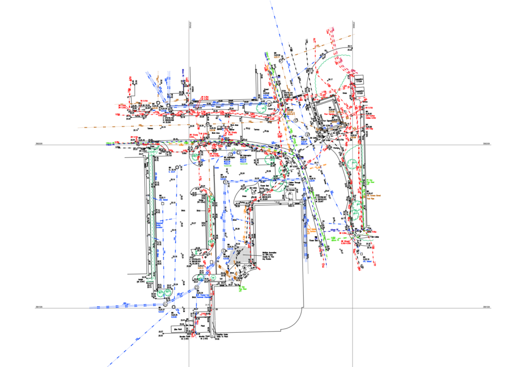
Consider a large-scale land development project where timely and accurate topographic survey data are crucial. Using KeyTERRA-FIRMA Base with BricsCAD Pro, a survey team can import the survey data directly in CAD as near finish quality topo survey drawing, significantly cutting down the time from survey to plan.
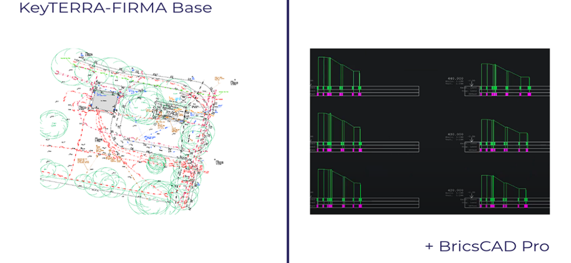
Advanced Section Creation Tools*
Creating detailed cross-sections, long sections and profiles is essential for effective planning and analysis in civil engineering projects. KeyTERRA-FIRMA Base enhances BricsCAD Pro by providing advanced tools for generating and managing these sections more efficiently. The software’s intuitive interface allows engineers to quickly create sections that accurately represent terrain variations, which are crucial for calculating volumes, designing road alignments, and planning drainage systems.
*KeyTERRA-FIRMA Base can create sections from most 3D entities in CAD drawings. For creating sections from surfaces / ground models you can use BricsCAD Pro section functions. KeyTERRA-FIRMA Ground Modeling module (sold separately) is required to create sections from surfaces / ground models.


Enhanced Visualization
With KeyTERRA-FIRMA Base, sections and profiles are not just accurate but visually compelling, making it easier to communicate complex data to stakeholders and team members.
Seamless Workflow Integration
The integration of KeyTERRA-FIRMA Base into the BricsCAD Pro environment is designed to be intuitive and fluid. This compatibility ensures that users can easily toggle between different functionalities without the need to switch between multiple software platforms, thereby saving time and reducing the likelihood of errors.
Data Handling Excellence
The combined power of these tools ensures that data integrity is maintained with every project, supporting a reliable workflow from initial survey to final plan.
Tangible Benefits for Surveyors and Civil Engineers
The collaboration between KeyTERRA-FIRMA Base and BricsCAD Pro doesn’t just streamline processes—it enhances them. Surveyors and civil engineers can expect:
- Increased Productivity: Projects that previously took days can now be completed in hours with reduced manpower.
- Cost Efficiency: Reduced time on tasks translates to cost savings on projects, enabling companies to allocate resources to other critical areas.
- Improved Accuracy: Minimize errors with advanced data handling and analysis features, leading to better project outcomes and fewer revisions.
Conclusion
KeyTERRA-FIRMA Base and BricsCAD Pro together form a winning combination for any civil engineering or surveying professional seeking to enhance their capabilities in topographic survey and section creation. This integration not only saves time and money but also ensures that project outputs are of the highest quality. Embrace the future of civil engineering with KeyTERRA-FIRMA Base and BricsCAD Pro.
Ready to transform your civil engineering or surveying workflow? Contact us today to learn more about how KeyTERRA-FIRMA Base and BricsCAD Pro can be integrated into your projects and to schedule a demo.